Flight Deck Connect™ by Air Sat One

Air Sat One provides World-Wide Datalink for AFIS/ACARS, FANS 1/A and VDL Mode 2 through the Iridium Satcom, Inmarsat Satcom and VHF networks.

We deliver Datalink communications to and from the flight deck through the Aeronautical Telecommunication Network (ATN) to Air Traffic Control (ATC).

Air Sat One's Flight Deck Datalink Solutions are compatible with all airframes, and all avionics manufactures equipment including Electronic Flight Bags (EFB).

Datalink Price Guide
Datalink Coverage Map
FANS 1/A (ADS-C & CPDLC), CNS/ATM, Datalink, AFIS / ACARS & CPDLC-DCL

Flight Deck Connect™ by Air Sat One

Air Sat One provides World-Wide Datalink for AFIS/ACARS, FANS 1/A and VDL Mode 2 through the Iridium Satcom, Inmarsat Satcom and VHF networks. We deliver Datalink communications to and from the flight deck through the Aeronautical Telecommunication Network (ATN) to Air Traffic Control (ATC). Datalink traffic is routed through our network to a variety of axillary networks allowing us to provide critical information to the flight deck and to allow communications with Flight Service and Support providers.

Any aircraft equipped with the appropriate Datalink Communications equipment can take advantage of this service. Air Sat One's Flight Deck Datalink Solutions are compatible with all airframes, and all avionics manufactures equipment including Electronic Flight Bags (EFB).


Features & Benefits

Satcom Datalink
  • Iridium & Inmarsat - Worldwide access
VHF Datalink
  • VHF and VDL Mode 2. Access in over 160 countries worldwide. (SITA & ARINC)
Air Traffic Services
  • FANS: ADS-C and CPDLC
  • North Atlantic Tracks (NAT), Hawaii Tracks, Pacific Ocean Tracks (FLEX)
  • Pre departure and Oceanic Clearances
  • D-ATIS: Digital ATIS
  • TWIP: Transcribed Weather Information for Pilots
  • ATC Advisory
  • CPDLC-DCL
Flight Deck
  • METARS / TAF's / NOTAM's / SIGMET's / PIREP's / Winds Aloft
  • Email, fax and message from FMS
  • Aircraft to Aircraft Communications
  • Messaging via Type B & Type X
Operations
  • Aircraft Messaging
  • OOOI (Out, Off, On, In)
  • Engine/Airframe health and fault reports
  • Pre-flight Maintenance Checks through our exclusive CNS/ATM test station, check basic ADS-C and CPDLC functionality - available 1Q 2016.
Access
  • Internetworking with SITA, ARINC, AEROTHAI (Thailand), ADCC (China), DECEA (Brazil) & AVICOM (Japan).
Flight Planning & Flight Support
  • Choose one of our Flight Support Service partners or bring your own.
Support
  • 24/7 365 Support
Billing
  • Yearly or Monthly billing with no additional fees.

Additional Datalink Services

Additional Datalink Services

Weather Graphics Unlimited graphical weather updates.
Flight Planning via SITA AIRCOM™ Aircraft operators need a straightforward tool to calculate the most efficient and cost-effective flight plan for every flight. The AIRCOM™ FlightPlanner provides tools to optimize the operational parameters of a flight considering fuel, time and navigation costs. The AIRCOM™ FlightPlanner application selects the best route possible for each flight. The flight plan is based on a complex analysis of aircraft performance, weather data, and route validation, combined with air traffic management routing requirements. AIRCOM FlightPlanner is integrated with SITA's AIRCOM™ ACARS Services so that route information can be uplinked directly to the aircraft flight management system.
Flight Tracking Air Sat One's Flight Tracking provides enhanced aircraft position awareness with regular flight position updates and requires no modification to the aircraft. It uses multiple data feeds (ADS-B, ACARS and ANSP Radar) to monitor aircraft. Combined, this data accurately displays aircraft positions on Google Maps with other operational data.
3rd Party Flight Planning and Support Services Integration with Flight Planning and Flight Support Service providers.
EFB Electronic Flight Bag (EFB) Hardware and Software Installation and Uploads.
Testing & Troubleshooting Air Sat One has advanced capabilities that allow us to duplicate an actual ATS (Air Traffic Services) work station using the live ATN (Air Traffic Network) to test ACARS and FANS 1/A functionality. Testing from the aircraft is achieved by logging on to our ICAO code through the FMS. Service will be available 1Q 2016. For more information see Air Sat One FANS 1/A Testing: Flight Deck Datalink Solutions

FANS 1/A or CNS/ATM

FANS 1/A and Satellite Communications

Both Inmarsat and Iridium can be used for FANS 1/A. The Iridium system must be FANS compliant and certified to DO-178B Level D. If your aircraft has an Inmarsat system only Inmarsat Aero H and Aero H+ are approved for FANS, SwiftBroadband and Swift 64 is not approved. An STC is required for installation and operation in the FANS environment along with a LOA (Letter of Authorization) from the FAA or other regulatory agency depending on the country of registration.

FANS consists of ADS-C and CPDLC.
ADS-C

Automatic Position Reports known as ADS-C, C meaning "Contract", requires no pilot interaction and the tower will initiate a contract with the reporting system. Another way to look at it is the tower will control the reporting system, allowing ATC to be able to control the frequency of reports. i.e. 1 position report every 5 minutes and they can also tell the system to report if the aircraft deviates from flight parameters. ADS-C replaces voice Position Reporting.

There are 3 types of contracts: 1) Periodic 2) Event 3) Demand. Event Contracts that are available in ADS- C acft are 1) Vertical Rate Change Event 2) Lateral Deviation Event 3) Altitude Range Change Event 4) Waypoint Change event.

CPDLC - Controller Pilot Datalink Communications (Text Messaging)

CPDLC Datalink communications allows for the direct exchange of text-based pre-formatted messages between a controller and a pilot and replaces voice communications over HF. CPDLC also replaces voice communications over VHF relieving the burden on VHF communications which is out of frequencies.

FANS Routes

FANS Routes allow more direct flights to the destination. Polar Routes allow the aircraft to take advantage of great circle navigation which is a more direct route to countries such as China. Both FANS and Polar Routes save time, fuel, money and carbon emissions.

Dynamic Aircraft Route Planning

DARP (Dynamic Aircraft Route Planning) and User Preferred Routings are available for FANS equipped airplanes. Pilots can change routes based on real winds instead of forecasted winds.

No Altitude Loss When Crossing Tracks

FANS allow more accurate position reporting, flight crew can control their speed to maintain separation instead of being forced to change altitude.

More reliable and efficient communications.

Communications using CPDLC is clear, reliable and reduces the response time to a few minutes for altitude change requests allowing the flight crew to take advantage of optimum altitude reducing fuel burn.

What is Datalink?

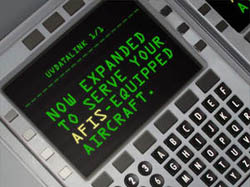
Datalink typically consists of AFIS/ACARS Flight Plan Winds Update, Graphical and Textural Weather, OOOI (Out, Off, On, In) Reports, Pre-Departure Clearance & Oceanic Clearance. The newest service available through Datalink using the ACARS communications medium is FANS 1/A or CNS/ATM. Other services available through Datalink are EFB Messaging, Flight Following and connection to flight support services.

What is AFIS?

Aerodrome Flight Information Service (AFIS)

Aerodrome Flight Information Service (AFIS) is the term used to describe the provision of information useful for the safe and efficient conduct of aerodrome traffic at aerodromes where the Air Traffic Service Provider determines that the provision of aerodrome control service is not justified, or is not justified on a 24-hour basis. AFIS is not intended to be used at aerodromes designated as regular or alternate aerodromes for international commercial air transport operations.

The basic elements of information to be provided to aircraft by an AFIS unit should include, as appropriate, the following:

a. Meteorological information for aircraft about to take off or to land, including SIGMET information. Such information should, to the extent possible, be the same as that provided to aerodrome traffic by aerodrome control towers, i.e.:

  • The current surface wind direction and speed, including significant variations;
  • The QNH altimeter setting and, either on a regular basis in accordance with local arrangements or if so requested by the aircraft, the QFE altimeter setting;
  • The air temperature for the runway to be used, in the case of take-off by turbine-engine aircraft;
  • The current visibility representative of the direction of take-off and initial climb, or in the approach and landing area, if less than 10 km, or, when available to the AFIS officer, the current runway visual range for the runway to be used;
  • Significant meteorological conditions in the take-off and climb-out area, or in the approach and landing area. This includes the occurrence or expected occurrence of cumulonimbus or thunderstorm, moderate or severe turbulence, wind shear, water spout.
  • The present weather and the amount and height of base of low cloud, in the case of aircraft making an approach in Instrument meteorological conditions;

b. Information enabling the pilot to select the most suitable runway for use. Such information should include, in addition to the current surface wind direction and speed, the "preferred runway" and traffic pattern and, on request by the pilot, the length of the runway(s) and/or the distance between an intersection and the end of the runway; Note - The term "preferred runway" is used to indicate the most suitable runway at a particular time, taking into account the current surface wind direction and speed and other relevant factors such as the traffic pattern end the runway used by other aircraft, with the intention of establishing and maintaining an orderly flow of aerodrome traffic.

c. Information on known aircraft, vehicles or personnel on or near the maneuvering area or aircraft operating in the vicinity of the aerodrome, which may constitute a hazard to the aircraft concerned;

d. Information on aerodrome conditions which is essential to the safe operation of aircraft, Such information should, to the extent possible, be the same as that provided to aerodrome traffic by aerodrome control towers, i.e. information relating to the following:
  • Construction or maintenance work on, or immediately adjacent to the maneuvering area;
  • Rough or broken surfaces on a runway or a taxiway, whether marked or not; water on a runway;
  • Other temporary hazards, including parked aircraft and birds on the ground or in the air;
  • Failure or irregular operation of part or all of the aerodrome lighting system;- any other pertinent information;

e. Information on changes in the operational status of non-visual navigation aids and visual aids essential for aerodrome traffic;

f. Radio bearings or direction-finding information, when equipment is available.

g. Messages, including clearances, received from other ATS units for relay to aircraft (e.g. from the associated flight information center (FIC) or area control center (ACC)); and

h. Any other information contributing to safety.

What is ACARS?

What is Aircraft Communications Addressing and Reporting System (ACARS)

ACARS is a digital datalink system for transmission of short messages between aircraft and ground stations via VHF radio or through the Iridium or Inmarsat satellite network.

ACARS messages may be of three broad types:

1. Air Traffic Control messages which are used to request or provide clearances.
2. Aeronautical Operational Control
3. Airline Administrative Control

OOOI events

A major function of ACARS is to automatically detect and report changes to the major flight phases, respectively Out of the gate, Off the ground, On the ground, and Into the gate (OOOI). OOOI events are detected using input from aircraft sensors such as doors, parking brake and strut switch sensors. At the start of each flight phase, an ACARS message is transmitted to the ground describing the flight phase, the time at which it occurred, and other related information such as the amount of fuel on board or the flight origin and destination. These messages are used to track the status of aircraft and crews.

Flight Plans and Weather

ACARS interfaces with FMS flight management systems, acting as the communication system for flight plans and weather information to be sent from the ground to the FMS. This enables the aircraft operator to update the FMS while in flight, and allows the flight crew to evaluate new weather conditions or alternative flight plans.

Equipment health and maintenance data

ACARS is used to send information from the aircraft to ground stations about the conditions of various aircraft systems and sensors in real-time. Maintenance faults and abnormal events are also transmitted to ground stations along with detailed messages, which are used by the aircraft operators or airframe OEM's for monitoring equipment health, and to plan repair and maintenance activities.

Manually sent messages

ACARS interfaces with interactive display units in the cockpit, which flight crews can use to send and receive technical messages and reports to or from ground stations, such as a request for weather information or clearances or the status of connecting flights. The response from the ground station is received on the aircraft via ACARS as well.

VHF AIRCOM

The VHF AIRCOM service provides a data communications service to aircraft equipped with ACARS avionics using a network of ground stations that are deployed throughout the world. VHF AIRCOM ground stations are connected via the data network to the AIRCOM ACARS Datalink Services Traffic Processor.

VDL AIRCOM

VDL AIRCOM (Very High Frequency Digital Link) offers a transition for air/ground Datalink communications from ACARS to ICAO FANS (Future Air Navigation System) compatible radio communications. VDL AIRCOM provides aircraft with increased capacity, as it offers 10 to 20 times more capacity per VHF channel than plain old ACARS. VDL AIRCOM is based on a new VHF network architecture, made up of the new VHF Ground Stations (VGS). In order to allow a smooth transition from ACARS to ATN, VGS can simultaneously support:

  • VHF AIRCOM - Plain Old ACARS (POA),
  • VDL AIRCOM - ACARS Over AVLC (AOA), and
  • ATN AIRCOM - VDL Mode2 sub-network service.

VHF AIRCOM Internetworking

The VHF AIRCOM Internetworking service enables user aircraft outside the VHF/VDL AIRCOM coverage zones to use ACARS ground stations operated by organizations that have established an internetworking agreement. Internetworking partner networks are compatible with avionics qualified to use the VHF/VDL AIRCOM network. To use the service, the avionics must be programmed with the VHF frequency used by the internetworking partners. The precise frequencies to be used are supplied when a user subscribes for the service. The Datalink Service Processors of AVICOM Japan are connected to the ADLT to provide user ground systems with access to aircraft via ground stations operated by the internetworking partners. Use of the VHF AIRCOM Internetworking service is accounted for separately from the usage of the operated VHF/VDL AIRCOM Service.

Satellite AIRCOM ACARS Datalink Service

Satellite AIRCOM Services provide worldwide, instantly available high quality voice and data communications between the ground and equipped aircraft. These air-ground communications serve the needs of a variety of users on the ground as well as in the aircraft, which may include cockpit and cabin crew, air traffic controllers, airline flight operations, management or passengers. Satellite AIRCOM Services are offered through the AIRCOM ground infrastructure and the Inmarsat, MTSAT and Iridium Satellite communication networks.

Inmarsat Satellite AIRCOM Services Overview

Spanning the globe, the Inmarsat AIRCOM service has been serving the airline industry since 1991. Historically, Inmarsat AIRCOM satellite services have been provided via the third generation Inmarsat satellites. This interconnects via four ground stations known as Ground Earth Stations (GES) and Satellite Access Stations (SAS) to 'land' or 'terminate' the traffic. Inmarsat Satellite AIRCOM supports AOC and AAC type of communications with appropriate priorities. Passenger Communications (APC) are also supported. The Inmarsat Satellite AIRCOM ACARS Datalink service covers all packet-mode data communications to and from the AIRCOM ACARS Datalink Services Traffic Processor. It forms part of the AIRCOM ACARS Datalink Services which provides a mobile wireless data communication service to aircraft around the world. AIRCOM supports flight operations, engineering, administration, and passenger communication requirements.

Iridium Satellite AIRCOM Services Overview

The Iridium Satellite AIRCOM Services consists of an extension to the Global Datalink Plus Services. They provide worldwide data communications between the ground and suitable-equipped aircraft. Iridium Satellite AIRCOM Services use the Iridium satellite communications network to provide global coverage including over the polar regions. Through inter-satellite cross-links, which allow voice calls to be relayed from one satellite to the next until the ground-based Gateway is reached, Iridium Satellite network allows data traffic to be routed virtually anywhere in the world between aircraft and the AIRCOM ACARS Datalink Traffic Processor. Configuration is required to the End User's Airborne Equipment's International Mobile Equipment Identifier (IMEI) to allow the End User's aircraft to use the Iridium Satellite gateway to access the AIRCOM ACARS Datalink Services Traffic Processor and the Global Datalink Plus Services which are supported for its Airborne Equipment. It is the user's responsibility to ensure that the Iridium Satellite Data Units (SDUs) installed in the aircraft have successfully passed the Validation and Assessment Qualification (VAQ).

Aircraft Configuration:

Some aircraft are equipped with a number of DataLink systems to provide redundancy or for continued service when out of range of the other system(s). Iridium, Inmarsat and VHF are used as the communications transceiver to send and receive Datalink messages.

In Aircraft with multiple systems a typical configuration is to use VHF AFIS as a default, when the Communications Management Unit (CMU) or the Data Management Unit (DMU) detects a loss of communications with the VHF AFIS system it will automatically establish connection through the Satellite Communication System.

When both Iridium and Inmarsat Satcom systems are installed in the aircraft the Iridium system will typically be used when outside of Inmarsat coverage area. Aircraft flying polar routes rely heavily on continued communications through the Iridium system which provides global coverage.

Not sure how your aircraft is configured?

Air Sat One has a feature in our sign up process that allows the Account Administrator to grant limited access to your Avionics Installation/Service Facility or to your Aircraft Mechanic allowing the aircraft configuration to be completed.

When you grant user access, an automatic email will be generated and sent to the user inviting them to complete the configuration section; be sure you have the contact information handy when signing up for service.


Activate Flight Deck Voice or Datalink Services

Air Sat One offers Flight Deck Voice and Datalink Services to customers with compatible Satcom equipment. Activate an account today, tell us about you aircraft and equipment and activate your service with Air Sat One.

Datalink Coverage Map
VHF
VHF CPDLC Coverage Map.
Inmarsat
Inmarsat Aero H and H+ Coverage Map.
Iridium
Iridium CPDLC, Datalink and FANS 1/A Coverage Map.
NATS
ADS-C
NAS Data Comm Guide